This past summer, a federal appeals court ruled Google Earth images and other similar content could be admitted during trial as evidence. The case at hand concerned the arrest of an immigrant by the Arizona-Mexico border. The immigrant claimed he was arrested in Mexico, rather than on U.S. soil, however one of the agents who made the arrest recorded the precise coordinates of the arrest on his handheld GPS device. At the trial, the satellite image produced by Google was used as evidence that the arrest occurred in the U.S. While the man’s attorney argued the Google Earth satellite image was hearsay, the court ruled the image does not amount to hearsay as there is no human intervention and the image “makes no assertion.” In other words, the computer program, rather than the person, did the real work. The ruling was a big win for the use of multimedia in the courtroom, and will no doubt have interesting repercussions in the world of trial support technology.
Using Google Earth and Google Street View in Premises Liability Cases
When reading this ruling, premises liability attorneys across the United States likely had an “a-ha” moment. Consider that one of the most important elements in a premises liability case is proving notice of the dangerous condition. Using Google Street View, it may now be possible to determine whether the condition in question existed for a sufficient length of time to enable the defendant to discover it. Those who have experienced a traumatic accident may not always remember the details as clearly as their attorney would wish. There can be an illusionary response from the brain during an accident which can fragment the person’s exact memories of the accident.
Using Google Street View can help rebuild the surroundings at the scene of the accident by showing obstructions, showing whether there were signs noting a hazard, or showing just how long a specific hazard existed. Google Street View can allow you to time-travel back as far as six years. This could be crucial in a premises liability case in which a person was injured by a hazard which was corrected soon after the accident. By using Google Street View, it could potentially be shown that the hazard actually existed for a significant length of time, prior to the accident.
How to Use Google Street View
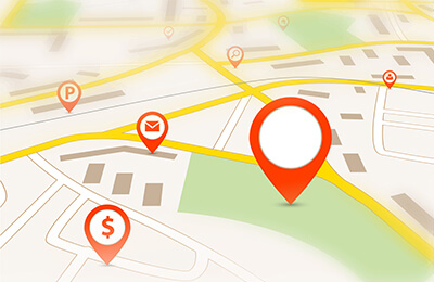
While Google Maps are often referred to in a general sense, there are many features contained within Google Maps such as Street View, Earth, Terrain, Traffic and Bicycling, all of which allow you to access unique information and data which can potentially supplement your premises liability case. You will first install Google Earth by going to https://www.google.com/earth/, and following the download instructions. If you are not familiar with Google Street View, you can access it as follows:
- Go to google.com/maps;
- Enter a street address;
- Left click on the “peg-man,” dragging the circle that accompanies him to the area you want to view, and
- The Street View Image, along with an “image capture date,” will appear.
Further Reading: Content Marketing for Attorneys – 5 Reasons You Should Leverage Your Expertise
Authenticating a Google Street View Photo
There are essentially two ways to authenticate the resulting photo. A witness can testify the photo is a true and correct image of the specific condition at the time the photo was taken. If this is not sufficient, a request for admission to establish authenticity, if admitted, would allow the photo to be authenticated for trial. If the photo cannot be authenticated by either of the two ways above, the custodian of records for Google can be subpoenaed in order to authenticate the photograph—obviously the most difficult and time-consuming way to authenticate.
Google Street View—the Good and the Bad
Google offers a feature which provides Street Views at various times; once you go to Street View, you will be shown a range of photos from different dates. Clients who delay contacting an attorney for an extremely long time could benefit greatly from Google Street View, as the scene of the accident could potentially be revisited as it looked years prior. There are a couple of downsides to using Google Earth as well; neither Google Maps nor Google Street View are updated in real time, meaning the physical scene of the accident should always be investigated as quickly as possible in order to confirm Google Street View evidence. Additionally, there are certain rural locations, as well as neighborhoods in outlying rural or suburban areas, which will not be available on Google Street View.
Helping Our Clients with Technology
 Google Maps, Google Street View, and other social media may truly be a game-changer for those with premises liability cases by providing an entirely new way of gathering evidence, particularly for those in which structures, signs, lighting, railings, snowy or icy sidewalks or blocked signs might be an issue. If you would like to learn more about how Google Maps could assist your case, or are curious about how we can help you use multimedia in the courtroom to give you an advantage in trial, give Law Father a call at 1-720-420-4931 or fill out our contact form.
LAWFATHER BUILDS FIRMS
Contact LawFather